Slide 7 of 18
Notes:
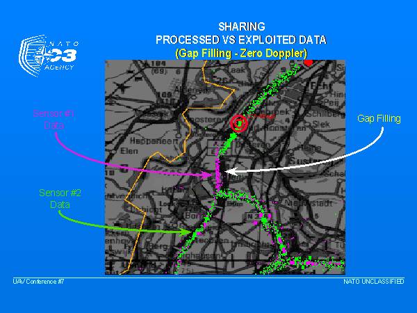
In this slide we can see an example, produced in a simulation on the AGS testbed, of MTI data from two data sources, one shown in green and the other in magenta.
In this scenario, a convoy was proceeding along the road from the bottom right corner towards the middle of the screen. At that point, without the data from the second sensor, the operator may not have been able to tell that the convoy had in fact turned to the north at the the top of the screen. Even though he may have later re-acquired the convoy, it is likely he would not have associated it with the original convoy due to the length of time over which he had had no detections. In addition, he could easily been deceived by background traffic proceeding to the south from the junction and miss-tracked and miss-reported the convoy’s position.
In this case the green sensor platform was flying to the west and thus the relative motion of the convoy during the “gap” produced no target doppler, so the sensor did not make a detection. One can see from this that if two platforms are available, they should be positioned as close as possible to 90 degrees apart from the area to be surveyed in order that zero doppler conditions can be avoided.


