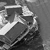
FARGO, ND, 11-APR-97
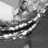
FARGO, ND, 11-APR-97

FARGO, ND, 11-APR-97


The news media is increasingly using aerial imagery to report a variety of stories. This sample of this product is intended to indicate imagery interpretability ratings that are judged to be usable for news reporting purposes.
The short answer is that aerial imagery used for news reporting typically seems to have a National Imagery Interpretability Rating Scale (NIIRS) of Level 7, which is in the ballpark of the 10-centimeter resolution obtainable from American national systems, such as the Improved Keyhole. Less frequently news reports are illustrated with imagery of approximately NIIRS Level 6, which is in the ballpark of the 1-meter resolution obtainable from commercial imagery satellite systems.
Estimable sources for this product included
 FARGO, ND, 11-APR-97 |
 FARGO, ND, 11-APR-97 |
 FARGO, ND, 11-APR-97 |
 GRAND FORKS, ND, 20-APR-97 |
 GRAND FORKS, ND, 21-APR-97 |
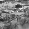 GRAND FORKS, ND, 19-APR-97 |
 GRAND FORKS, ND, 19-APR-97 |