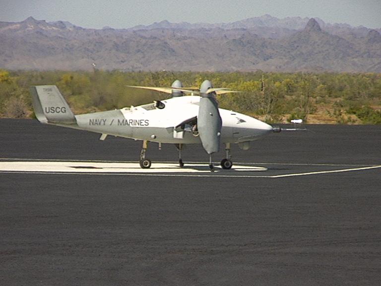

Eagle Eye UAV
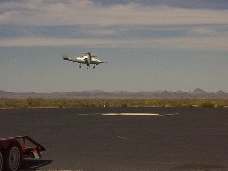
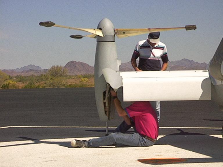
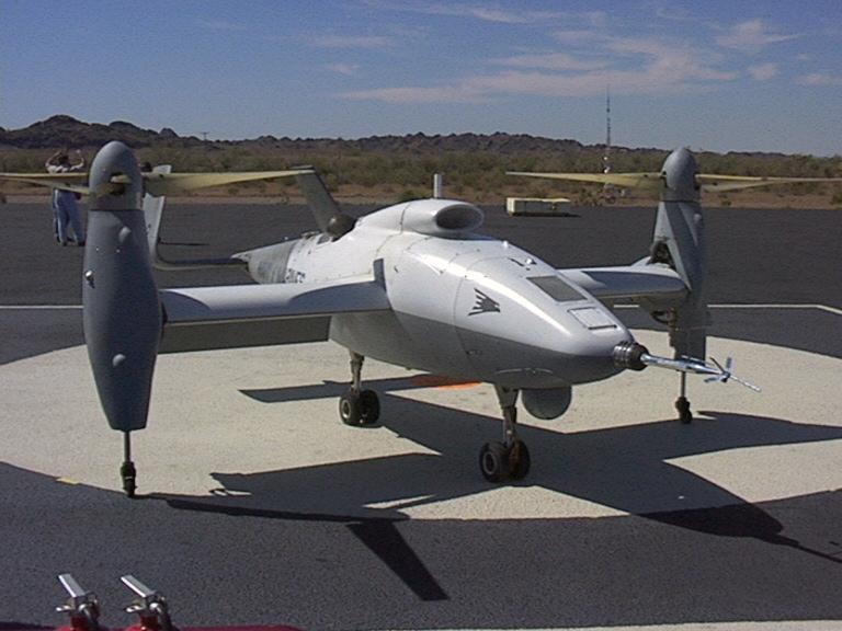
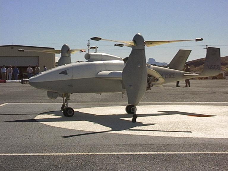
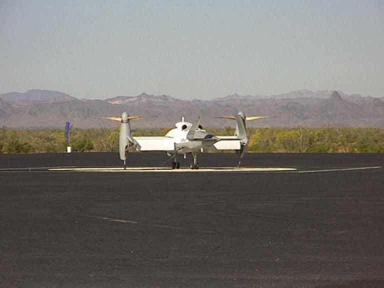
The Bell Eagle Eye has the appearance of a conventional aircraft with tilt rotors at the end of each wing that allow it to maneuver up or down and hover. Bell Helicopter Textron Incorporation (BHTI) became involved with the Unmanned Aerial Vehicle (UAV) program by taking the wind tunnel V-22 model, using off the shelf helicopter parts, i.e., engine, drive shafts, gear boxes, etc. and built the Eagle Eye tilt rotor UAV. The Eagle Eye has a wing span of 15.2 ft, is 17.9 ft in length, is 5.7 ft high, and weighs around 2,000 pounds (depending on payload). The first flight test (hover only) were conducted at BHTI facility in Dallas, Texas during the winter/spring of 1992. After successful hover flight tests, the government and contractor teams moved to Yuma Proving Grounds (YPG) for flight test during the third quarter of 1993. The flight tests were very successful and the Eagle Eye flew in helicopter mode, converted through the transition mode to aircraft mode. 35 flights were conducted with a total flight time of 15 hours. Average flight hour per sortie was .43 hrs/flt. Maximum airspeed attained was 159 knots at an operating altitude of 1,550 feet above Mean Sea Level (MSL). The government had no further Vertical Take Off and Landing (VTOL) requirements and concluded all VTOL demonstration/development contract actions. BHTI continued to develop the Eagle Eye with in house R&D dollars. In the spring of 1998 the government once again wanted a demonstration of VTOL air vehicle capabilities and contracted BHTI to demonstrate the flying qualities and performance characteristics of the Eagle Eye. This became a two Phase program. Phase I was a land based flight demonstration and Phase II will be sea based flight demonstration. Phase I was accomplished in April 1998. The aircraft has flown more than 43 times, exceeding 55.5 flight hours and achieving airspeed of more than 200 knots, with an altitude of 14,600 feet during the demonstration at Yuma Proving Ground. Phase II of the program is scheduled for the last quarter of FY99 and will be conducted aboard a small Naval combatant.This matrix outlines performance demonstrated during the VTOL UAV landbased demonstration at Yuma Proving Grounds. This demonstration called for up to 50 flight hours in a 90 day period.
Specifications
Manufacturer Bell Helicopter - Textron, Texas AV Type Tilt Rotor Length 17.9/5.46 (ft/m) Height 5.7/1.73 (ft/m) Wingspan 15.2/4.63 (ft/m) Rotospan (diam) 9.5/2.90 (ft/m) Take-Off Gross Weight 2250/1020 (lbs/kg) Empty Weight 1300/590 (lbs/kg) Fuel Weight 750/340 (lbs/kg) Payload Weight 200/90 (lbs/kg) Speed (kts) Max 200+, Cruise 0-200 Altitude 20,000/6,100 (ft/m) Endurance 8 hours Radius of Operation 110/200 LOS (nm/km) Engine Allison 250-C20 GT 420 shp Fuel Heavy.JP Landing Gear Wheeled/Retractable Flight Control Automated/Dual Redundant Availability Development Take Off/Landing VTOL/STOL AV Data Link(s) S-Band/UHF (TCDL future) Payload FLIR - EO/IR - SAR
PARAMETER
OBJECTIVE
METRIC
DEMONSTRATED
xx xx xx Total
Last Flt
Air Vehicle VTOL xx xx xx xx xx Sorties
43 1 xx xx Total Flight Time (hrs)
55.5 2.3 xx xx Longest Sortie (hrs)
2.3 2.3 Radius of Action2 110 nm Max Range (nm)
20.6 20.6 xx xx Max Rng Ltd by
datalink datalink xx xx External Pilot
Datalink range (nm)20.6 approx 1.0 xx xx Internal Pilot
Datalink range (nm)20.6 20.6 xx xx Payload
Datalink range (nm)20.6 20.6 Time to Station3 < 1 hr Time to 20 nm loiter point (min)
approx 9 minutes approx 9 minutes Time on Station4 3 hr Time @ 20nm loiter (hrs)
1.7 1.7 Airspeed 0 to 150 kts Max Airspeed (kts)
190 kias* 180 kias Maximum Operating Altitude at least 13,000 ft MSL Max Altitude
(ft MSL)14,005 Hp** 10,000 Hp Shipboard Launch/ Recovery Area all air capable ships – 24’ Spot Avg Distance from Intended Ldg Point (ft)
xx 2 Launch/ Recovery Wind-Over-Deck
up to at least 20 kts Launch/Recovery
Max Wind (kts)12/16G32 2-5 /VAR Shipboard Launch/ Recovery Capability Automatic with manual backup and waveoff capability; touch and go n/a n/a xx xx Auto T/O & Ldgs
0/0 0/0 xx xx Manual T/O & Ldgs
43/43 1/1 xx xx Touch & Go’s
1 0 xx xx Waveoffs Int/Unint
0/1 0/0 Environmental Protection full EMI protection EMI SOFT
No EMI Noted No EMI Noted xx Protected from and resistant to degrading effects of sand, dust, and salt-laden air; operate in light icing Sand/Dust degradations
None Noted None Noted AV Operational Temperature - 20 deg F to 120 deg F (start, T/O) Max/Min OAT(deg F)
93/49 84/77 xx --note these numbers are at the field-- Max/Min Press in Hg
29.72/
29.0029.15
PARAMETER
OBJECTIVE
METRIC
DEMONSTRATED
xx xx xx Total
Last Flt
Recover at TOGW Yes Recover at TOGW
max TO/LDG wt (lbs)1954 /
16541954 /
1654Launch/Recovery
Accuracy9.8 ft during launch/recovery; TO/LDG accuracy (ft)
5 / 10
2
Spatial Location Accuracy 82 ft in-flight NAV accuracy (ft)
34.6
not calc’d xx xx TGT accuracy
n/a
n/a
Navigation Capability autonomous navigation; automatic execution of lost link and emergency recovery procedures; automatic loiter on command; transmit magnetic heading information and self-location xx xx xx xx xx Auto-navigation
waypoint select and designate waypoint select and designate xx xx Automatic lost link
3 links plus return home 3 links plus return home xx xx Automatic loiter
0 kias inertial velocity demoed not demoed Payload Capacity at least 200 lb; 2.5 kW power for payload; internal/external payload area of at least 2 cubic feet; day/night passive imagery sensor Max Payload carried:
Weight (lbs)
Power
Cu209 (includes TM gear) 200 (includes TM gear + FSI 3000 FLIR/TV) Navigation Lights comply with FAA regulations; capable of activation/
deactivation from GCS at maximum rangeExt Lights control
From GCSStrobe only Strobe only Mission Reliability5 at least 75% xx xx 100%
xx xx Avg Flt Hrs/Sortie
1.3
2.3
xx xx Takeoff Times:
Planned vs. Actualxx 0700/
0713xx xx Sortie Completion %
CANX – WX
CANX – MAINT
CANX – OPSxx 100%
0
0
0
xx xx Maint Actions/Flt Hr
Maint Hrs/Flt Hr
xx 0
xx xx Down Gripes
9 0 xx xx In-flight Aborts
9 0 xx xx Data Set Completion
% Plan vs. Actualapprox 95% 100%
(1) All performance objectives are specified under standard day conditions unless otherwise noted
(2) Air vehicle performance objective using line-of-sight datalink. Datalink range does not need to support demonstration of this objective.
(3) With 200 lb modular mission payload, flying in 25 kt headwind.
(4) With 200 lb modular mission payload.
(5) Mission Reliability is defined as the capability to complete a mission without a critical failure that would prevent the continuance of the mission. A successful mission includes mission planning, AV launch, AV proceeding to and loitering at the target area while performing planned or immediate tasks while simultaneously relaying MMP information to the supported commander, and AV recovery. Inclement weather, last minute changes in airspace coordination, and airspace interlopers will not count against mission success.* Air data system preliminary cal indicates approximately 200 knots calibrated airspeed.
* Air data system preliminary cal indicates approximately 15,000 feet calibrated pressure altitude.
Air View
Rotor ViewFlight at Yuma Proving Grounds (YPG) Preflight
Ground Views Right View Front View Left View Right View
Rear View
Left View
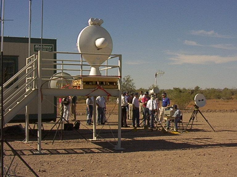
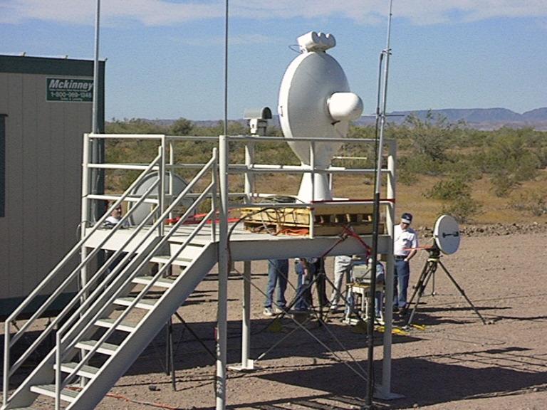
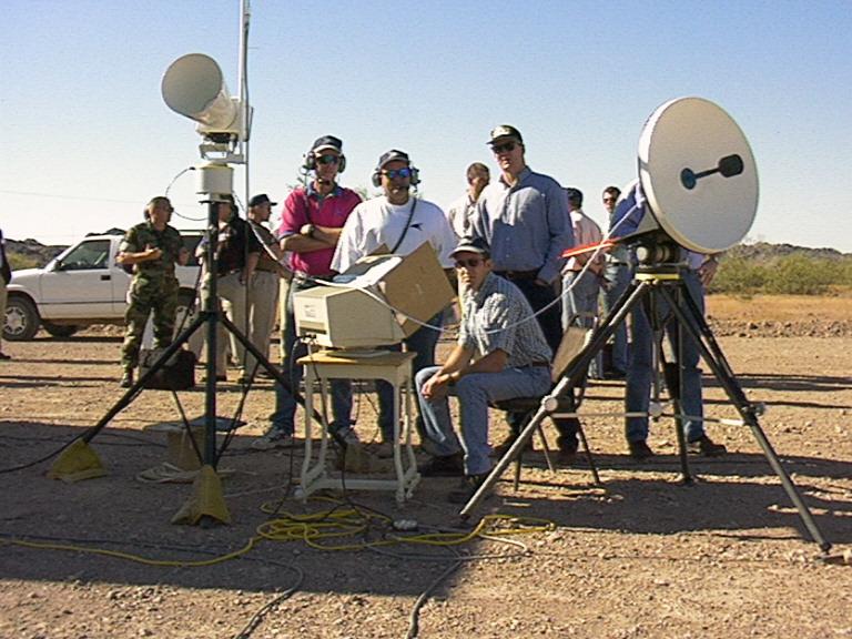
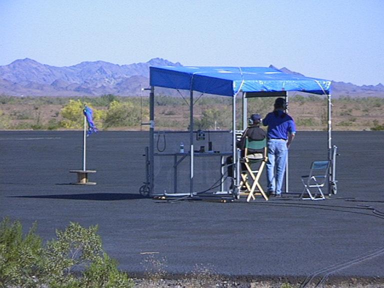
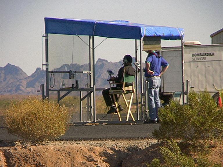
Communications
&
NavigationAntenna Antenna Comms Navigiation Center Navigation Center Sources and Methods
- Eagle Eye NAVY Unmanned Aerial Vehicles PMA 263