FAS | Intelligence | IMINT Gallery | Search | Join FAS


Hyperspectral Imaging
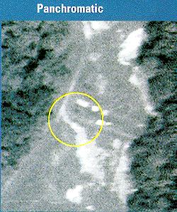
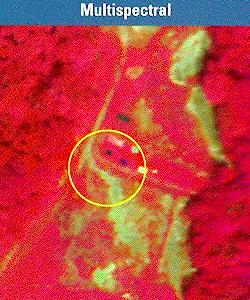
The utility of subdividing the ultraviolet, visible and infrared spectra into distinct bins for imaging has long been known. In Multispectral Imaging (MSI), multiple images of a scene or object are created using light from different parts of the spectrum. If the proper wavelengths are selected, multispectral images can be used to detect many militarily important items such as camouflage, thermal emissions and hazardous wastes to name a few.A primary goal of using multispectral/hyperspectral remote sensing image data is to discriminate, classify, identify as well as quantify materials present in the image. Another important applications are subpixel target detection, which allows one to detect targets of interest with sizes smaller than the pixel resolution, and abundance estimation, which allows one to detect concentrations of different signature spectra present in pixels. In remote sensing image analysis, the difficulty arises in the fact that a scene pixel is mixed linearly or nonlinearly by different materials resident in the pixel where direct applications of commonly used image analysis techniques generally do not work well.

- The EO-1 Mission: Hyperion data
- Three revolutionary land imaging
instruments on EO-1 are collecting multispectral and hyperspectral scenes in coordination with Landsat-7 (August 4, 2001) [1.7 MB PDF file].
- Web Resources on Hyperspectral Sensors
-
From Opto-Knowledge Systems, Inc.
- Hyperspectral Systems
- A collection of links from the US Geological Survey
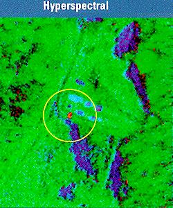
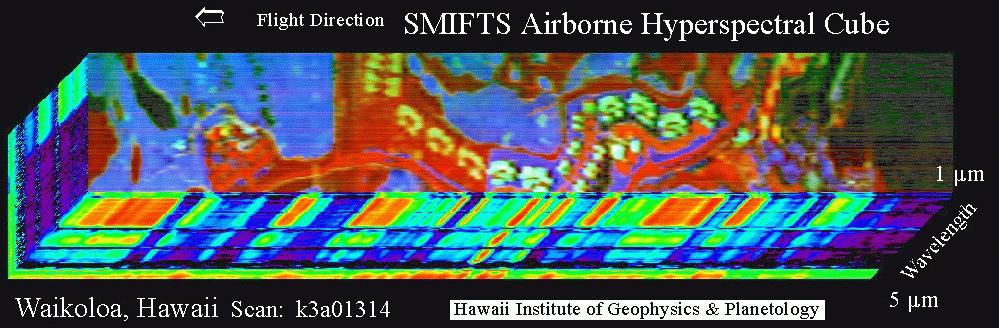
This image of Waikoloa, HI was obtaind at a flight altitude of 6000 feet. The top face of the image cube is a three channel color composite with: red= 3.73 um; green = 2.12 um; blue = 1.27 um. The base of the image cube is at approximately 5 um. Sides of the cube show, in pseudocolor, the intensity of spectral response of the pixels along the edge of the image, with red being the greatest and dark blue/black the least. Vegetated areas are bright in the shorter wavelengths; rocky areas are bright in the longer wavelengths.
Features in image: Ocean to right. Most other black areas are water hazards on golf course or trees. Grassy areas are blue; light blue are sand traps. Red are asphalt, bare rock or gravel. Bright white/green areas are condominium roofs. Yellow/green structures (in large red area) are concrete foundations for new condominiums.
FAS | Intelligence | IMINT Gallery | Search | Join FAS
http://www.fas.org/irp/imint/hyper.htm
Created by John Pike
Maintained by Steven Aftergood