Fallujah, Iraq
This Space Imaging IKONOS image of Fallujah, Iraq was taken on November 14, 2004.
For full enlargement (12 MB), click
here
Photo Credit: Space Imaging Middle East
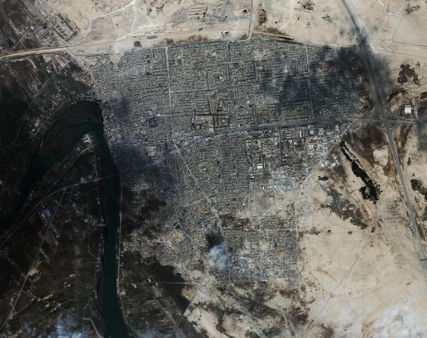
Photo Credit: Space Imaging Middle East
For full enlargement (12 MB), click
here
Metadata file for Space Imaging product

Image

File         : fallujah_sime_11_14_04.tif
Projection   : UTM zone 38
Datum        : WGS84
Ellipsoid    : WGS84
GSD          : 1.000000000000000 Meters
Upper Left   : 382510.958605, 3693575.820777
Lower Right  : 390875.958605, 3686942.820777
Coordinates refer to the center of the pixel
Geographic coordinates for corners
Upper Left   : 43.736971 deg lon, 33.375024 deg lat
Upper Right  : 43.826879 deg lon, 33.375906 deg lat
Lower Right  : 43.827681 deg lon, 33.316090 deg lat
Lower Left   : 43.737834 deg lon, 33.315210 deg lat
Image Size   : 8366 samples, 6634 lines, 3 bands
Produced by  : Space Imaging
maintained by 